
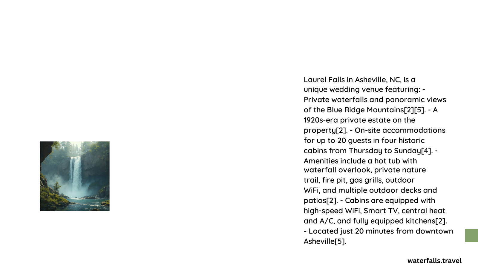
Laurel Falls, located near Asheville, North Carolina, is a popular hiking destination known for its stunning 80-foot waterfall. This trail offers a moderate hike through lush forests, culminating in breathtaking views of cascading water. While often confused with the Laurel Falls in the Great Smoky Mountains, this Asheville gem provides a unique experience for nature enthusiasts and photographers alike.
What Makes Laurel Falls Asheville Unique?
Laurel Falls near Asheville is distinct from its namesake in the Great Smoky Mountains. This waterfall is situated in the Pisgah National Forest, offering a less crowded and more secluded experience. The trail to Laurel Falls Asheville winds through a diverse ecosystem, showcasing the rich biodiversity of the Southern Appalachians.
Where Is Laurel Falls Located in Relation to Asheville?
Laurel Falls is located approximately 35 miles northwest of Asheville in the Pisgah National Forest. The trailhead is accessible via Highway 215, which can be reached by taking I-26 West from Asheville and then following US-64 West.
| Distance from Asheville | Approximate Drive Time |
|---|---|
| 35 miles | 1 hour |
How Difficult Is the Hike to Laurel Falls?
The hike to Laurel Falls is considered moderate in difficulty. Here are some key details:
- Trail Length: 3.6 miles round trip
- Elevation Gain: Approximately 1,000 feet
- Estimated Time: 2-3 hours
The trail features some steep sections and rocky terrain, requiring a moderate level of fitness and proper footwear.
What Is the Best Time to Visit Laurel Falls?
The best time to visit Laurel Falls depends on your preferences:
- Spring (March-May): Wildflowers bloom, and water flow is strong due to spring rains.
- Summer (June-August): Warmer temperatures, but more crowded.
- Fall (September-November): Beautiful foliage colors, comfortable hiking temperatures.
- Winter (December-February): Less crowded, potential for icy conditions on the trail.
For optimal waterfall views, visit after periods of rain when the water flow is at its peak.
What Should I Bring for the Hike?
To ensure a safe and enjoyable hike to Laurel Falls, consider packing the following items:
- Sturdy hiking boots
- Water (at least 2 liters per person)
- Snacks or a light lunch
- Weather-appropriate clothing (layers recommended)
- Sun protection (hat, sunscreen, sunglasses)
- First aid kit
- Camera
- Trekking poles (optional, but helpful on steep sections)
Are There Any Safety Concerns for the Laurel Falls Hike?
While the Laurel Falls trail is well-maintained, there are some safety considerations:
- Slippery Rocks: Exercise caution near the waterfall, as rocks can be extremely slippery.
- Wildlife: Be aware of potential wildlife encounters, including black bears.
- Weather Changes: Mountain weather can change rapidly, so be prepared for sudden shifts.
- Trail Conditions: Some sections may be steep or have exposed roots, requiring careful footing.
What Are the Best Photography Spots at Laurel Falls?
For photographers, Laurel Falls offers several prime shooting locations:
- Base of the Falls: Capture the full height of the waterfall.
- Mid-Trail Vistas: Several spots along the trail offer scenic views of the surrounding mountains.
- Upper Falls Section: A less crowded area with unique perspectives of the cascades.
Tips for photographers:
– Use a tripod for long-exposure shots of the waterfall.
– Visit during early morning or late afternoon for optimal lighting.
– Consider using a polarizing filter to reduce glare from wet surfaces.
Are There Any Nearby Attractions to Laurel Falls?
After visiting Laurel Falls, consider exploring these nearby attractions:
- Looking Glass Falls: A 60-foot waterfall visible from the roadside.
- Sliding Rock: A natural water slide popular in summer months.
- Pisgah Center for Wildlife Education: Learn about local flora and fauna.
- Blue Ridge Parkway: Scenic drive with numerous overlooks and hiking trails.
How Does Laurel Falls Compare to Other Waterfalls Near Asheville?
Laurel Falls is one of many beautiful waterfalls in the Asheville area. Here’s a comparison:
| Waterfall | Height | Hike Distance | Difficulty |
|---|---|---|---|
| Laurel Falls | 80 feet | 3.6 miles | Moderate |
| Looking Glass Falls | 60 feet | Roadside | Easy |
| Catawba Falls | 100 feet | 3 miles | Moderate |
| Linville Falls | 90 feet | 1.6 miles | Easy to Moderate |
Each waterfall offers a unique experience, with Laurel Falls providing a good balance of accessibility and natural beauty.
What Are the Parking Options for Laurel Falls?
Parking for the Laurel Falls trail is available at the trailhead off Highway 215. Key points:
- Limited parking spaces available
- No parking fee required
- Arrive early on weekends and holidays to secure a spot
- Overflow parking may be available along the roadside (use caution)
Are There Any Regulations I Should Be Aware of When Visiting Laurel Falls?
When visiting Laurel Falls, please adhere to the following regulations:
- Practice Leave No Trace principles
- Keep dogs on leash at all times
- No camping or fires near the waterfall
- Stay on designated trails to prevent erosion
- Do not climb on or around the waterfall
- Pack out all trash
By following these guidelines, you help preserve the natural beauty of Laurel Falls for future visitors.
Laurel Falls near Asheville offers a rewarding hiking experience with stunning views of a majestic waterfall. Whether you’re a nature enthusiast, photographer, or casual hiker, this trail provides a perfect blend of challenge and scenic beauty. Plan your visit to coincide with optimal weather conditions, bring appropriate gear, and prepare to be amazed by one of Western North Carolina’s natural wonders.